


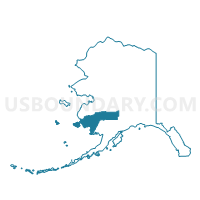
Lower Kalskag Precinct, Bethel Census Area, Alaska
About
Outline

Summary
| Unique Area Identifier | 523288 |
| Name | Lower Kalskag Precinct |
| County | Bethel Census Area |
| State | Alaska |
| Area (square miles) | 1.72 |
| Land Area (square miles) | 1.22 |
| Water Area (square miles) | 0.49 |
| % of Land Area | 71.21 |
| % of Water Area | 28.79 |
| Latitude of the Internal Point | 61.51581280 |
| Longtitude of the Internal Point | -160.35763520 |
Maps


Graphs
Select a template below for downloading or customizing gragh for Lower Kalskag Precinct, Bethel Census Area, Alaska


Neighbors
Neighoring Voting District (by Name) Neighboring Voting District on the Map
- Aniak Precinct (Part; Also See Part In Wade Hampton Census Area), Bethel Census Area, AK
- Upper Kalskag Precinct, Bethel Census Area, AK